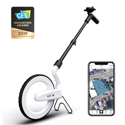
Carta/Mapping Wheel, First Measurement Wheel To Virtually Map Any Space, Draws The Path Users Walk In Real Time Over Imported Images, Blueprints & Satellite Images, Add Notes, Images & Videos To A Project To Create A Control Center For Any Project, All On A Mobile Device, When Finished Mapping Out A Project, Revisit Points To Build Or Plan With Cartas Guidance Mode.